Zip Codes with the Highest Percentage of Population Employed in Professional & Scientific Services in Maine
RELATED REPORTS & OPTIONS
Professional & Scientific Services
Maine
Compare Zip Codes
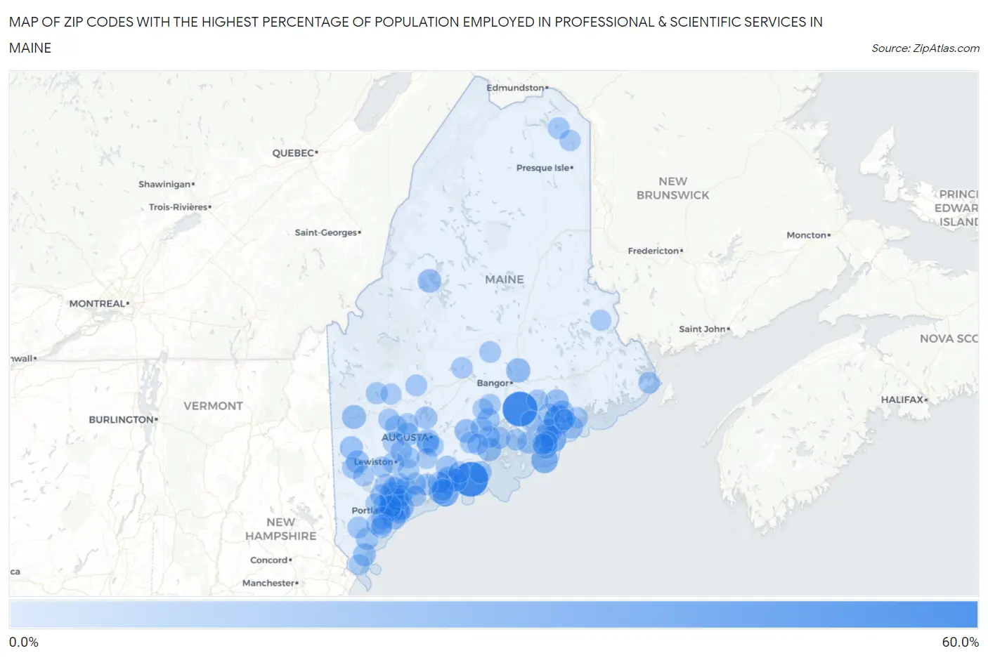
Map of Zip Codes with the Highest Percentage of Population Employed in Professional & Scientific Services in Maine
0.0%
60.0%
Zip Codes with the Highest Percentage of Population Employed in Professional & Scientific Services in Maine
| Zip Code | % Employed | vs State | vs National | |
| 1. | 04431 | 53.3% | 6.3%(+47.0)#1 | 7.8%(+45.5)#46 |
| 2. | 04855 | 53.1% | 6.3%(+46.8)#2 | 7.8%(+45.3)#48 |
| 3. | 04677 | 31.7% | 6.3%(+25.4)#3 | 7.8%(+23.9)#183 |
| 4. | 04635 | 25.0% | 6.3%(+18.7)#4 | 7.8%(+17.2)#426 |
| 5. | 04544 | 24.3% | 6.3%(+18.0)#5 | 7.8%(+16.5)#478 |
| 6. | 04675 | 23.1% | 6.3%(+16.7)#6 | 7.8%(+15.2)#572 |
| 7. | 04609 | 20.2% | 6.3%(+13.8)#7 | 7.8%(+12.3)#866 |
| 8. | 04109 | 20.0% | 6.3%(+13.7)#8 | 7.8%(+12.2)#887 |
| 9. | 04050 | 19.4% | 6.3%(+13.0)#9 | 7.8%(+11.5)#965 |
| 10. | 04021 | 18.2% | 6.3%(+11.9)#10 | 7.8%(+10.4)#1,119 |
| 11. | 04489 | 17.2% | 6.3%(+10.9)#11 | 7.8%(+9.37)#1,315 |
| 12. | 04105 | 17.0% | 6.3%(+10.7)#12 | 7.8%(+9.17)#1,358 |
| 13. | 04568 | 16.9% | 6.3%(+10.5)#13 | 7.8%(+9.03)#1,394 |
| 14. | 04237 | 16.7% | 6.3%(+10.3)#14 | 7.8%(+8.82)#1,439 |
| 15. | 04653 | 16.2% | 6.3%(+9.82)#15 | 7.8%(+8.31)#1,568 |
| 16. | 04573 | 15.9% | 6.3%(+9.57)#16 | 7.8%(+8.06)#1,639 |
| 17. | 04949 | 15.9% | 6.3%(+9.55)#17 | 7.8%(+8.04)#1,641 |
| 18. | 04843 | 15.7% | 6.3%(+9.35)#18 | 7.8%(+7.85)#1,699 |
| 19. | 04660 | 15.3% | 6.3%(+8.94)#19 | 7.8%(+7.43)#1,810 |
| 20. | 04108 | 15.2% | 6.3%(+8.90)#20 | 7.8%(+7.40)#1,816 |
| 21. | 04634 | 15.1% | 6.3%(+8.80)#21 | 7.8%(+7.30)#1,855 |
| 22. | 04478 | 15.0% | 6.3%(+8.68)#22 | 7.8%(+7.18)#1,888 |
| 23. | 04097 | 14.7% | 6.3%(+8.38)#23 | 7.8%(+6.88)#2,001 |
| 24. | 04576 | 13.9% | 6.3%(+7.55)#24 | 7.8%(+6.04)#2,319 |
| 25. | 04101 | 13.7% | 6.3%(+7.32)#25 | 7.8%(+5.81)#2,409 |
| 26. | 04284 | 13.7% | 6.3%(+7.31)#26 | 7.8%(+5.81)#2,410 |
| 27. | 04664 | 13.4% | 6.3%(+7.05)#27 | 7.8%(+5.54)#2,542 |
| 28. | 04679 | 13.4% | 6.3%(+7.02)#28 | 7.8%(+5.51)#2,560 |
| 29. | 04267 | 13.3% | 6.3%(+6.99)#29 | 7.8%(+5.49)#2,570 |
| 30. | 04347 | 13.3% | 6.3%(+6.92)#30 | 7.8%(+5.41)#2,604 |
| 31. | 04032 | 13.2% | 6.3%(+6.90)#31 | 7.8%(+5.39)#2,611 |
| 32. | 04564 | 13.2% | 6.3%(+6.89)#32 | 7.8%(+5.38)#2,618 |
| 33. | 04057 | 13.2% | 6.3%(+6.87)#33 | 7.8%(+5.36)#2,625 |
| 34. | 04107 | 13.0% | 6.3%(+6.65)#34 | 7.8%(+5.14)#2,721 |
| 35. | 03907 | 12.5% | 6.3%(+6.18)#35 | 7.8%(+4.68)#2,927 |
| 36. | 04102 | 12.2% | 6.3%(+5.90)#36 | 7.8%(+4.39)#3,071 |
| 37. | 04917 | 12.1% | 6.3%(+5.78)#37 | 7.8%(+4.28)#3,128 |
| 38. | 04553 | 11.6% | 6.3%(+5.22)#38 | 7.8%(+3.71)#3,467 |
| 39. | 04915 | 11.4% | 6.3%(+5.08)#39 | 7.8%(+3.57)#3,559 |
| 40. | 04043 | 11.3% | 6.3%(+4.99)#40 | 7.8%(+3.48)#3,627 |
| 41. | 04848 | 11.3% | 6.3%(+4.96)#41 | 7.8%(+3.46)#3,639 |
| 42. | 04669 | 11.3% | 6.3%(+4.95)#42 | 7.8%(+3.44)#3,647 |
| 43. | 04092 | 11.3% | 6.3%(+4.93)#43 | 7.8%(+3.42)#3,659 |
| 44. | 04074 | 11.2% | 6.3%(+4.89)#44 | 7.8%(+3.39)#3,679 |
| 45. | 04616 | 11.1% | 6.3%(+4.74)#45 | 7.8%(+3.23)#3,791 |
| 46. | 04096 | 11.0% | 6.3%(+4.70)#46 | 7.8%(+3.19)#3,815 |
| 47. | 04110 | 10.9% | 6.3%(+4.61)#47 | 7.8%(+3.10)#3,881 |
| 48. | 04859 | 10.9% | 6.3%(+4.55)#48 | 7.8%(+3.04)#3,926 |
| 49. | 04103 | 10.8% | 6.3%(+4.51)#49 | 7.8%(+3.00)#3,952 |
| 50. | 04640 | 10.3% | 6.3%(+3.91)#50 | 7.8%(+2.41)#4,375 |
| 51. | 04571 | 10.2% | 6.3%(+3.89)#51 | 7.8%(+2.39)#4,398 |
| 52. | 04344 | 10.0% | 6.3%(+3.68)#52 | 7.8%(+2.17)#4,557 |
| 53. | 04285 | 9.9% | 6.3%(+3.58)#53 | 7.8%(+2.08)#4,647 |
| 54. | 04849 | 9.9% | 6.3%(+3.56)#54 | 7.8%(+2.06)#4,659 |
| 55. | 04253 | 9.9% | 6.3%(+3.56)#55 | 7.8%(+2.05)#4,662 |
| 56. | 04538 | 9.8% | 6.3%(+3.43)#56 | 7.8%(+1.92)#4,769 |
| 57. | 04002 | 9.6% | 6.3%(+3.29)#57 | 7.8%(+1.79)#4,900 |
| 58. | 04783 | 9.6% | 6.3%(+3.28)#58 | 7.8%(+1.78)#4,908 |
| 59. | 04530 | 9.4% | 6.3%(+3.10)#59 | 7.8%(+1.60)#5,054 |
| 60. | 04009 | 9.4% | 6.3%(+3.05)#60 | 7.8%(+1.54)#5,106 |
| 61. | 04911 | 9.4% | 6.3%(+3.03)#61 | 7.8%(+1.52)#5,127 |
| 62. | 04652 | 9.3% | 6.3%(+2.95)#62 | 7.8%(+1.44)#5,203 |
| 63. | 04280 | 9.2% | 6.3%(+2.90)#63 | 7.8%(+1.39)#5,257 |
| 64. | 04011 | 9.2% | 6.3%(+2.88)#64 | 7.8%(+1.37)#5,271 |
| 65. | 04862 | 9.2% | 6.3%(+2.87)#65 | 7.8%(+1.37)#5,279 |
| 66. | 04221 | 8.9% | 6.3%(+2.60)#66 | 7.8%(+1.10)#5,581 |
| 67. | 04650 | 8.9% | 6.3%(+2.57)#67 | 7.8%(+1.06)#5,607 |
| 68. | 04069 | 8.9% | 6.3%(+2.53)#68 | 7.8%(+1.02)#5,641 |
| 69. | 04062 | 8.8% | 6.3%(+2.42)#69 | 7.8%(+0.917)#5,742 |
| 70. | 04952 | 8.7% | 6.3%(+2.35)#70 | 7.8%(+0.848)#5,818 |
| 71. | 04422 | 8.6% | 6.3%(+2.27)#71 | 7.8%(+0.761)#5,906 |
| 72. | 04605 | 8.6% | 6.3%(+2.23)#72 | 7.8%(+0.722)#5,953 |
| 73. | 04680 | 8.4% | 6.3%(+2.07)#73 | 7.8%(+0.568)#6,116 |
| 74. | 04072 | 8.3% | 6.3%(+1.96)#74 | 7.8%(+0.451)#6,275 |
| 75. | 04236 | 8.3% | 6.3%(+1.95)#75 | 7.8%(+0.446)#6,282 |
| 76. | 04282 | 8.3% | 6.3%(+1.93)#76 | 7.8%(+0.421)#6,321 |
| 77. | 04349 | 8.3% | 6.3%(+1.92)#77 | 7.8%(+0.419)#6,322 |
| 78. | 04847 | 8.2% | 6.3%(+1.83)#78 | 7.8%(+0.320)#6,448 |
| 79. | 04551 | 8.0% | 6.3%(+1.71)#79 | 7.8%(+0.202)#6,592 |
| 80. | 04210 | 8.0% | 6.3%(+1.63)#80 | 7.8%(+0.125)#6,702 |
| 81. | 04063 | 8.0% | 6.3%(+1.62)#81 | 7.8%(+0.113)#6,714 |
| 82. | 04971 | 7.9% | 6.3%(+1.55)#82 | 7.8%(+0.044)#6,816 |
| 83. | 04612 | 7.9% | 6.3%(+1.54)#83 | 7.8%(+0.038)#6,828 |
| 84. | 04951 | 7.9% | 6.3%(+1.54)#84 | 7.8%(+0.032)#6,836 |
| 85. | 04039 | 7.7% | 6.3%(+1.40)#85 | 7.8%(-0.104)#7,003 |
| 86. | 04736 | 7.7% | 6.3%(+1.37)#86 | 7.8%(-0.137)#7,048 |
| 87. | 04684 | 7.7% | 6.3%(+1.36)#87 | 7.8%(-0.147)#7,061 |
| 88. | 04921 | 7.6% | 6.3%(+1.30)#88 | 7.8%(-0.200)#7,140 |
| 89. | 04252 | 7.6% | 6.3%(+1.29)#89 | 7.8%(-0.214)#7,165 |
| 90. | 04346 | 7.6% | 6.3%(+1.25)#90 | 7.8%(-0.257)#7,226 |
| 91. | 04607 | 7.5% | 6.3%(+1.20)#91 | 7.8%(-0.300)#7,280 |
| 92. | 04357 | 7.5% | 6.3%(+1.11)#92 | 7.8%(-0.391)#7,418 |
| 93. | 04064 | 7.3% | 6.3%(+1.00)#93 | 7.8%(-0.501)#7,592 |
| 94. | 03909 | 7.3% | 6.3%(+0.914)#94 | 7.8%(-0.591)#7,727 |
| 95. | 04984 | 7.3% | 6.3%(+0.912)#95 | 7.8%(-0.594)#7,730 |
| 96. | 04055 | 7.2% | 6.3%(+0.904)#96 | 7.8%(-0.601)#7,739 |
| 97. | 04038 | 7.2% | 6.3%(+0.904)#97 | 7.8%(-0.601)#7,740 |
| 98. | 04079 | 7.2% | 6.3%(+0.815)#98 | 7.8%(-0.690)#7,883 |
| 99. | 04492 | 7.1% | 6.3%(+0.801)#99 | 7.8%(-0.705)#7,919 |
| 100. | 04274 | 7.1% | 6.3%(+0.780)#100 | 7.8%(-0.725)#7,954 |
Common Questions
What are the Top 10 Zip Codes with the Highest Percentage of Population Employed in Professional & Scientific Services in Maine?
Top 10 Zip Codes with the Highest Percentage of Population Employed in Professional & Scientific Services in Maine are:
What zip code has the Highest Percentage of Population Employed in Professional & Scientific Services in Maine?
04431 has the Highest Percentage of Population Employed in Professional & Scientific Services in Maine with 53.3%.
What is the Percentage of Population Employed in Professional & Scientific Services in the State of Maine?
Percentage of Population Employed in Professional & Scientific Services in Maine is 6.3%.
What is the Percentage of Population Employed in Professional & Scientific Services in the United States?
Percentage of Population Employed in Professional & Scientific Services in the United States is 7.8%.