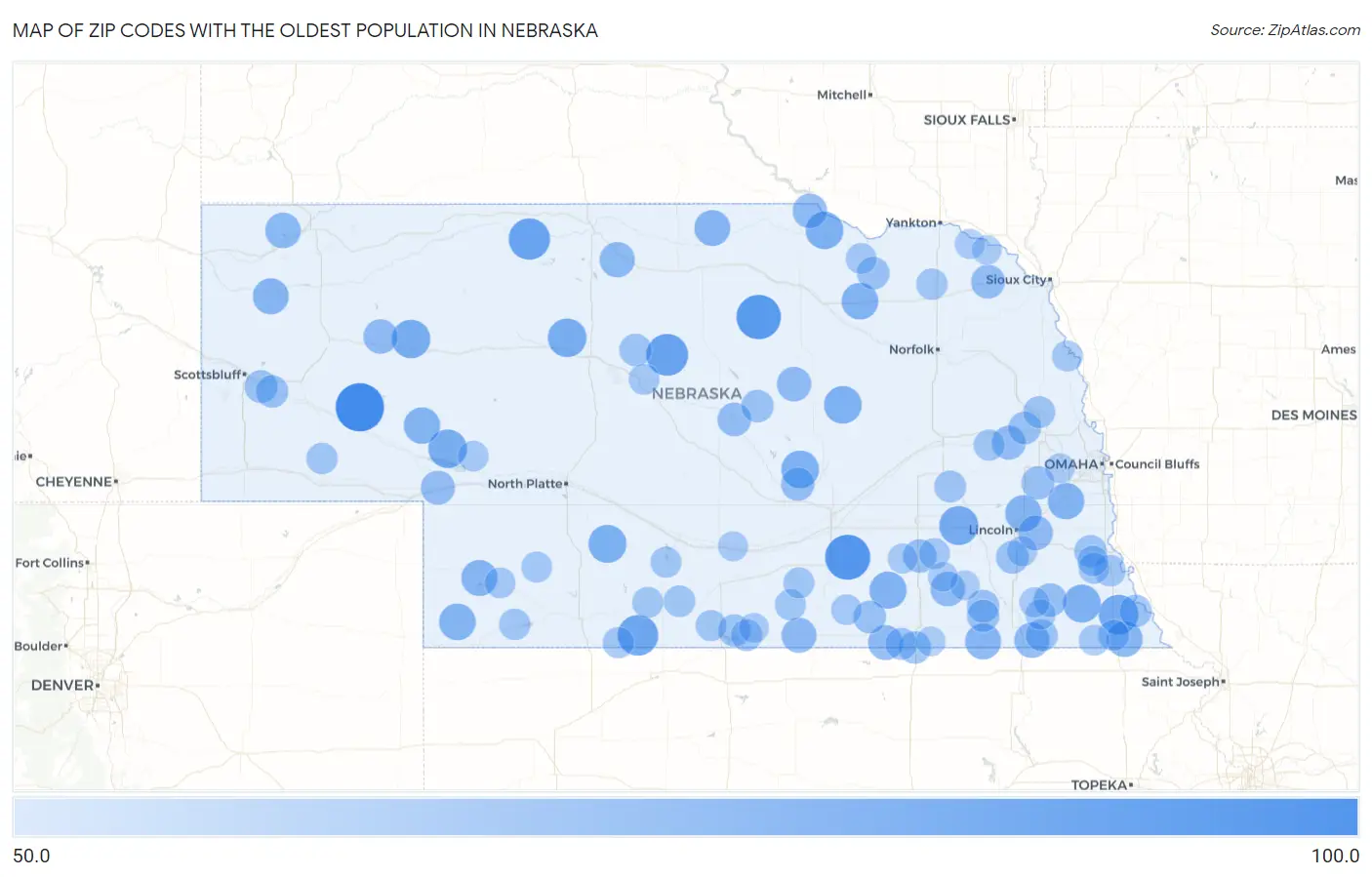
Zip Codes with the Oldest Population in Nebraska
RELATED REPORTS & OPTIONS
Oldest Population
Nebraska
Compare Zip Codes
Map of Zip Codes with the Oldest Population in Nebraska
50.0
100.0
Zip Codes with the Oldest Population in Nebraska
| Zip Code | Median Age | vs State | vs National | |
| 1. | 69148 | 81.4 | 36.9(+44.5)#1 | 38.5(+42.9)#35 |
| 2. | 68954 | 76.3 | 36.9(+39.4)#2 | 38.5(+37.8)#82 |
| 3. | 68711 | 75.4 | 36.9(+38.5)#3 | 38.5(+36.9)#98 |
| 4. | 68821 | 71.4 | 36.9(+34.5)#4 | 38.5(+32.9)#216 |
| 5. | 69219 | 70.6 | 36.9(+33.7)#5 | 38.5(+32.1)#253 |
| 6. | 69046 | 69.5 | 36.9(+32.6)#6 | 38.5(+31.0)#328 |
| 7. | 68442 | 67.9 | 36.9(+31.0)#7 | 38.5(+29.4)#459 |
| 8. | 68364 | 67.0 | 36.9(+30.1)#8 | 38.5(+28.5)#533 |
| 9. | 69146 | 66.4 | 36.9(+29.5)#9 | 38.5(+27.9)#587 |
| 10. | 69161 | 66.4 | 36.9(+29.5)#10 | 38.5(+27.9)#591 |
| 11. | 69340 | 66.4 | 36.9(+29.5)#11 | 38.5(+27.9)#593 |
| 12. | 69039 | 65.3 | 36.9(+28.4)#12 | 38.5(+26.8)#725 |
| 13. | 68348 | 65.2 | 36.9(+28.3)#13 | 38.5(+26.7)#736 |
| 14. | 68838 | 65.1 | 36.9(+28.2)#14 | 38.5(+26.6)#746 |
| 15. | 68746 | 65.0 | 36.9(+28.1)#15 | 38.5(+26.5)#766 |
| 16. | 68655 | 65.0 | 36.9(+28.1)#16 | 38.5(+26.5)#770 |
| 17. | 68452 | 64.1 | 36.9(+27.2)#17 | 38.5(+25.6)#908 |
| 18. | 68773 | 63.6 | 36.9(+26.7)#18 | 38.5(+25.1)#971 |
| 19. | 69041 | 63.5 | 36.9(+26.6)#19 | 38.5(+25.0)#1,001 |
| 20. | 68058 | 63.3 | 36.9(+26.4)#20 | 38.5(+24.8)#1,027 |
| 21. | 69147 | 63.2 | 36.9(+26.3)#21 | 38.5(+24.7)#1,050 |
| 22. | 68514 | 63.1 | 36.9(+26.2)#22 | 38.5(+24.6)#1,081 |
| 23. | 69027 | 62.7 | 36.9(+25.8)#23 | 38.5(+24.2)#1,160 |
| 24. | 68433 | 62.6 | 36.9(+25.7)#24 | 38.5(+24.1)#1,177 |
| 25. | 68440 | 62.5 | 36.9(+25.6)#25 | 38.5(+24.0)#1,200 |
| 26. | 69354 | 62.4 | 36.9(+25.5)#26 | 38.5(+23.9)#1,238 |
| 27. | 68753 | 62.4 | 36.9(+25.5)#27 | 38.5(+23.9)#1,240 |
| 28. | 69367 | 61.8 | 36.9(+24.9)#28 | 38.5(+23.3)#1,396 |
| 29. | 68309 | 61.5 | 36.9(+24.6)#29 | 38.5(+23.0)#1,461 |
| 30. | 69221 | 61.3 | 36.9(+24.4)#30 | 38.5(+22.8)#1,511 |
| 31. | 68952 | 61.0 | 36.9(+24.1)#31 | 38.5(+22.5)#1,574 |
| 32. | 68943 | 60.7 | 36.9(+23.8)#32 | 38.5(+22.2)#1,642 |
| 33. | 68520 | 60.5 | 36.9(+23.6)#33 | 38.5(+22.0)#1,690 |
| 34. | 68453 | 60.5 | 36.9(+23.6)#34 | 38.5(+22.0)#1,708 |
| 35. | 68719 | 60.4 | 36.9(+23.5)#35 | 38.5(+21.9)#1,758 |
| 36. | 68637 | 60.2 | 36.9(+23.3)#36 | 38.5(+21.7)#1,820 |
| 37. | 69351 | 60.2 | 36.9(+23.3)#37 | 38.5(+21.7)#1,822 |
| 38. | 69127 | 59.5 | 36.9(+22.6)#38 | 38.5(+21.0)#2,015 |
| 39. | 68648 | 59.5 | 36.9(+22.6)#39 | 38.5(+21.0)#2,026 |
| 40. | 68732 | 59.4 | 36.9(+22.5)#40 | 38.5(+20.9)#2,077 |
| 41. | 68828 | 59.0 | 36.9(+22.1)#41 | 38.5(+20.5)#2,199 |
| 42. | 68354 | 58.6 | 36.9(+21.7)#42 | 38.5(+20.1)#2,303 |
| 43. | 68332 | 58.5 | 36.9(+21.6)#43 | 38.5(+20.0)#2,343 |
| 44. | 68820 | 58.4 | 36.9(+21.5)#44 | 38.5(+19.9)#2,374 |
| 45. | 68033 | 58.2 | 36.9(+21.3)#45 | 38.5(+19.7)#2,433 |
| 46. | 69355 | 57.8 | 36.9(+20.9)#46 | 38.5(+19.3)#2,579 |
| 47. | 68438 | 57.8 | 36.9(+20.9)#47 | 38.5(+19.3)#2,585 |
| 48. | 68621 | 57.7 | 36.9(+20.8)#48 | 38.5(+19.2)#2,604 |
| 49. | 68961 | 57.6 | 36.9(+20.7)#49 | 38.5(+19.1)#2,628 |
| 50. | 68424 | 57.4 | 36.9(+20.5)#50 | 38.5(+18.9)#2,703 |
| 51. | 69353 | 57.4 | 36.9(+20.5)#51 | 38.5(+18.9)#2,719 |
| 52. | 68327 | 57.3 | 36.9(+20.4)#52 | 38.5(+18.8)#2,747 |
| 53. | 68789 | 57.3 | 36.9(+20.4)#53 | 38.5(+18.8)#2,755 |
| 54. | 68837 | 57.3 | 36.9(+20.4)#54 | 38.5(+18.8)#2,757 |
| 55. | 68437 | 57.2 | 36.9(+20.3)#55 | 38.5(+18.7)#2,792 |
| 56. | 69157 | 57.2 | 36.9(+20.3)#56 | 38.5(+18.7)#2,800 |
| 57. | 68346 | 57.0 | 36.9(+20.1)#57 | 38.5(+18.5)#2,869 |
| 58. | 68377 | 57.0 | 36.9(+20.1)#58 | 38.5(+18.5)#2,876 |
| 59. | 68971 | 56.8 | 36.9(+19.9)#59 | 38.5(+18.3)#2,943 |
| 60. | 68381 | 56.7 | 36.9(+19.8)#60 | 38.5(+18.2)#2,991 |
| 61. | 68667 | 56.4 | 36.9(+19.5)#61 | 38.5(+17.9)#3,107 |
| 62. | 68072 | 56.3 | 36.9(+19.4)#62 | 38.5(+17.8)#3,139 |
| 63. | 68325 | 56.3 | 36.9(+19.4)#63 | 38.5(+17.8)#3,140 |
| 64. | 68936 | 55.9 | 36.9(+19.0)#64 | 38.5(+17.4)#3,313 |
| 65. | 68379 | 55.9 | 36.9(+19.0)#65 | 38.5(+17.4)#3,317 |
| 66. | 68960 | 55.7 | 36.9(+18.8)#66 | 38.5(+17.2)#3,381 |
| 67. | 69043 | 55.6 | 36.9(+18.7)#67 | 38.5(+17.1)#3,415 |
| 68. | 69141 | 55.6 | 36.9(+18.7)#68 | 38.5(+17.1)#3,418 |
| 69. | 68749 | 55.5 | 36.9(+18.6)#69 | 38.5(+17.0)#3,475 |
| 70. | 69036 | 55.4 | 36.9(+18.5)#70 | 38.5(+16.9)#3,513 |
| 71. | 68036 | 55.3 | 36.9(+18.4)#71 | 38.5(+16.8)#3,549 |
| 72. | 68932 | 55.2 | 36.9(+18.3)#72 | 38.5(+16.7)#3,603 |
| 73. | 68337 | 55.1 | 36.9(+18.2)#73 | 38.5(+16.6)#3,642 |
| 74. | 68937 | 55.0 | 36.9(+18.1)#74 | 38.5(+16.5)#3,666 |
| 75. | 68966 | 55.0 | 36.9(+18.1)#75 | 38.5(+16.5)#3,685 |
| 76. | 68948 | 55.0 | 36.9(+18.1)#76 | 38.5(+16.5)#3,694 |
| 77. | 68448 | 55.0 | 36.9(+18.1)#77 | 38.5(+16.5)#3,698 |
| 78. | 68950 | 55.0 | 36.9(+18.1)#78 | 38.5(+16.5)#3,699 |
| 79. | 68783 | 54.9 | 36.9(+18.0)#79 | 38.5(+16.4)#3,729 |
| 80. | 68351 | 54.9 | 36.9(+18.0)#80 | 38.5(+16.4)#3,732 |
| 81. | 69032 | 54.8 | 36.9(+17.9)#81 | 38.5(+16.3)#3,791 |
| 82. | 68833 | 54.8 | 36.9(+17.9)#82 | 38.5(+16.3)#3,804 |
| 83. | 68020 | 54.7 | 36.9(+17.8)#83 | 38.5(+16.2)#3,833 |
| 84. | 69045 | 54.6 | 36.9(+17.7)#84 | 38.5(+16.1)#3,878 |
| 85. | 68957 | 54.6 | 36.9(+17.7)#85 | 38.5(+16.1)#3,887 |
| 86. | 68345 | 54.6 | 36.9(+17.7)#86 | 38.5(+16.1)#3,897 |
| 87. | 68382 | 54.5 | 36.9(+17.6)#87 | 38.5(+16.0)#3,965 |
| 88. | 69144 | 54.4 | 36.9(+17.5)#88 | 38.5(+15.9)#4,020 |
| 89. | 68430 | 54.1 | 36.9(+17.2)#89 | 38.5(+15.6)#4,136 |
| 90. | 68458 | 53.9 | 36.9(+17.0)#90 | 38.5(+15.4)#4,255 |
| 91. | 68357 | 53.8 | 36.9(+16.9)#91 | 38.5(+15.3)#4,302 |
| 92. | 68792 | 53.5 | 36.9(+16.6)#92 | 38.5(+15.0)#4,448 |
| 93. | 68365 | 53.5 | 36.9(+16.6)#93 | 38.5(+15.0)#4,452 |
| 94. | 68929 | 53.5 | 36.9(+16.6)#94 | 38.5(+15.0)#4,456 |
| 95. | 68861 | 53.4 | 36.9(+16.5)#95 | 38.5(+14.9)#4,498 |
| 96. | 68464 | 53.2 | 36.9(+16.3)#96 | 38.5(+14.7)#4,596 |
| 97. | 68406 | 53.2 | 36.9(+16.3)#97 | 38.5(+14.7)#4,599 |
| 98. | 68069 | 53.1 | 36.9(+16.2)#98 | 38.5(+14.6)#4,618 |
| 99. | 68375 | 53.0 | 36.9(+16.1)#99 | 38.5(+14.5)#4,713 |
| 100. | 68751 | 53.0 | 36.9(+16.1)#100 | 38.5(+14.5)#4,715 |
Common Questions
What are the Top 10 Zip Codes with the Oldest Population in Nebraska?
Top 10 Zip Codes with the Oldest Population in Nebraska are:
What zip code has the Oldest Population in Nebraska?
69148 has the Oldest Population in Nebraska with 81.4.
What is the Median Age in the State of Nebraska?
Median Age in Nebraska is 36.9.
What is the Median Age in the United States?
Median Age in the United States is 38.5.